Surveyors in Stroud
Enquire Today in Stroud
Contact Us
Residential, Commercial and Industrial
Serving Engineers, Architects, Homeowners & Construction Businesses
Land & Construction Surveying Solutions
Solutions for Smarter Development
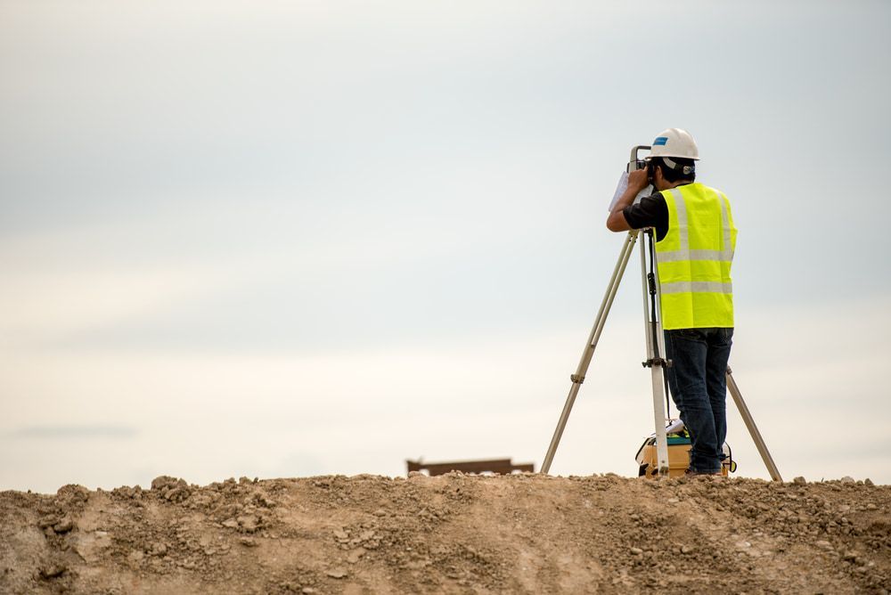
Accurate surveying is the backbone of every successful project—from residential property planning to large scale construction developments. At CalCo Surveyors, we provide precise land and construction surveying services backed by over 35 years of industry experience.
Using advanced Trimble RTK GPS, GNSS systems and UAV technology, we deliver the data that engineers, architects, builders and property owners need to make informed decisions. Whether you're defining boundaries, setting out a new build or preparing a subdivision, we ensure every detail is measured with precision.
If you're looking for reputable surveyors in Stroud, call (02) 6558 2255 today.
Services
From boundary verification to subdivision planning, our land surveying services in Stroud provide the precise measurements needed for legal compliance and smart land development.
Accurate set outs and site measurements are critical for a successful build. Our construction surveying in Stroud ensures every structure is positioned correctly, helping engineers and builders work with confidence.
We Service Every Industry
Surveying is more than just marking land—it’s about providing the insights that keep projects on track. At CalCo Surveyors, we use fully robotic S8 Total Stations and advanced aerial mapping to capture highly detailed measurements.
Our expertise helps prevent costly mistakes, resolve boundary concerns and streamline construction workflows. Whether you require a detailed land assessment, an accurate construction set out or large scale infrastructure mapping, we tailor our services to meet your needs.
With a reputation for delivering reliable surveying solutions in Stroud, we continue to support projects with accuracy, efficiency and professional service.

Nature's Symphony

Enquire Today in Stroud
Contact Details


Frequently Asked Questions
What locations do you service?
We service throughout the Mid North Coast region and surrounding areas including Gloucester, Taree, Harrington, Old Bar, Diamond Beach, Bulahdelah, Nabiac, Forster, Wingham and Stroud.
What is a flood level survey?
A flood level survey assesses land elevation relative to potential flood risks. It is required for certain developments and to determine building floor levels in flood prone areas.
Can surveyors provide legal documents for property disputes?
Yes, surveyors can produce certified boundary reports and cadastral plans which serve as legal evidence in property disputes, land claims and court cases.


